Tuesday, April 15, 2008

Brazilian Cities & Tourism: Jericoacoara | State of Ceará

Brazilian Cities & Tourism: Jericoacoara State of Ceará

Brazilian and foreign tourists that visit it can enjoy its astoundingly beautiful beaches, take buggy rides on its vast coastline, and sail in the ponds of crystal clear waters.

Located at 192,63 mi (310 km) West from Fortaleza, the capital city of the state of Ceará, Jericoacoara has some of the most beautiful beaches of the country and is filled with dunes and rocky steep walls, coconut trees, and a sea of incredibly blue waters. The natural beauties are such that they led to the creation of the Ubajara and Jericoacoara National Park, which cover a vast area around the town. With unpaved streets, the town preserves the charm and rusticity of a fishermen’s village. In the past, many of its charming lodges were used as residence by the inhabitants of the area. To get there, it is a good idea using special vehicles that can cover the miles of dunes separating the place from the nearest highway; or perhaps take one of the many bus lines that daily go there from Fortaleza. Discovery in the seventies by the hippies, Jeri, as it is often called, has in tourism its main source of income. At the end of the afternoon, tourists can watch the sun go down from an enormous dune. And, at night, after the night lights are on, the must is trying some of the delicious fish and seafood recipes in the local restaurants. And if there is still any energy left, the tourist can party all night long, enjoying the music of an authentic popular dance, the so-called forró, as well as all the excitement of the local bars. Those who visit the Jeri beach must also see the town of Jijoca de Jericoacoara, distant only 12,43 mi (20 Km) from there, filled with natural beauties and constant winds that are especially appreciated by those who practice water sports, such as kitesurf and windsurf.

Travel to Brazil Fotos Photos Pics Jericoacoara Ceara CE Brasil Tourism

Attractions
  • Jericoacoara Beach
Jericoacoara beach, close to the town, is a beautiful bay surrounded white sand dunes and coconut trees. Following the coast, either East or West, tourists find a succession of semi-wild beaches.

  • Jericoacoara National Park
Areas of Environmental Protection. Its greatest attraction is the Jericoacoara beach, but the area also includes fields, dunes, beaches of green waters, and the unique rocky formation known as Serrote (Handsaw). In the area, one may see several species of birds, even some endangered ones.

  • Buggy ride to Nova Tatajuba
Nova Tatajuba, distant 22,37 mi (36 Km) from there, is a fishermen’s village with just a few houses. It was rebuilt after the old village of Tatajuba having been covered by the dunes of the area, which moved by the action of the winds of the area. The sand buggy goes there by the dunes: it goes by beaches, crosses the Guriú River on a rustic raft, and passes by enormous sand formations and ponds that are excellent for a swim. At the end of the ride, tourists stop at a rustic little bar for some delicious snacks by the seashore.

  • Jijoca de Jericoacoara
In Jijoca tourists find the Azul pond (Blue Pond) and the Paraíso pond (Paradise pond), where trade winds make the place simply perfect for the sail sports. Access is gained by buggy and 4x4 vehicles, which leave the town of Jeri. The ponds are also excellent for swimming, kayak rides, mask diving, snorkeling, and fin swimming.

  • Sunset on the dunes
At the end of the afternoon, many people go up Jericoacoara’s highest dune, nearly 98,43 ft (30 m) tall, to watch the sun go down.

Monday, April 14, 2008

Brazilian Cities & Tourism: Ilha de Comandatuba | State of Bahia

Brazilian Cities & Tourism: Ilha de Comandatuba State of Bahia

The beautiful Comandatuba Island keeps a wealth of Brazilian fauna and flora throughout its stretch. The tours allow nice moments for being in touch with the well preserved Nature in this paradise. Activities in the island range from a simple and fulfilling rest under a coconut tree shade to an exciting golf match. For those who enjoy water activities, it is possible to adventure on high sea or canal fishing, around the island, or to experience the “adrenalin” of riding on a jet-ski amidst the wonderful landscape.

Attractions
  • Tours
At the tours, guided by qualified staff, guests get information on the amazing local ecosystem. There are some unmissable tours, such as the walk through the suspension bridges at the Una Ecologic Park and the Lama Negra Safari. Don’t miss the marsh, the Dona Vida farm, and a bit more about baiana culture in the cities of Ilhéus and Canavieiras, with their old mansions.

  • Golf Course
Built between the ocean and the marsh, inaugurated in July 2000, the Comandatuba Island Ocean Course is one of the main and better kept golf resorts in the Country. Ocean Course has 18 holes and four difficulty levels, defined by the “tees” (exits from each hole), three for men: distance varies between 5,712 and 6,928 yards, which makes it suitable for professionals and accessible for those new to the sport. Visit the Comandatuba Ocean Course on a motorized car, learning more about the sport in a beautiful landscape.

  • Rafting
At Aliança river, next to the city of Una, on a double vessel conducted by professionals.

  • Una Ecopark
Tour monitored by biologists on an Atlantic Forest reserve. Walk and visit to the 22 meters high runway at the top of the trees.

  • Buggy Ride
Buggy ride on the beach to Barra Sul, stopping at Lama Negra on the way back.

  • Quadricycle Rides
Exciting ride to Barra Norte on the beach and paths.

  • Jet Tour on the Marsh
Jet-ski ride on the marsh to Barra Sul – with a nautic instructor.

  • Round the Comandatuba Island
Motorboat ride around the Comandatuba Island, lasting two and a half hours.

  • Canal Fishing
Both fishing lovers and beginners will be amazed with the amount of species at the canal. Alloy boats with all the required gear for a good fishing session: artificial bait and pilot included.

  • Birdwatching
Follow the environmental guide on a walk at the golf course to learn about the fauna and flora of the island and watch native birds with binoculars.

  • Walk to Barra Norte
5km walk to Barra Norte. Schooner tour around the canal.

  • Cocoa Farm
For those who like chocolate, this is a good opportunity. Learn about planting, harvesting and all the production process of the “gold fruit”, the cocoa.

  • Lama Negra Tour
Navigate through the marsh canals to the south of the island for a black mud health bath. On the way, be in contact with the local community, fauna and flora. Includes sugar cane spirit tasting and bean soup, as well as support from an environmental guide.

  • Crabs Pathway
Tour monitored by an environmental guide to a pathway among the marsh trees for the observation of crabs, birds, typical trees and a demonstration of the arts of fishing and hunting made by a genuine crab hunter.

  • Tour to Barra Norte
Schooner tour to Barra Norte, one of the points where the canal meets the ocean.

  • Sunset
Schooner tour to enjoy a beautiful sunset at Barra Norte, with champagne and fruit.

  • Ecobike
Enjoy Nature in a different way. Bike ride on an Atlantic Forest path, at the Country farm.

Vicinity

  • Ilhéus City Tour
Know the history of Gabriela’s land and visit the places where some of Jorge Amado’s characters used to live.

  • Tour to Canavieiras
Visit a small cocoa farm and the historic centre of Canavieiras, where the first scenes of the famous Brazilian soap opera, “Gabriela, Cravo e Canela” were shot.

Sunday, April 13, 2008

Brazilian Cities & Tourism: Porto Alegre | State of Rio Grande do Sul

Brazilian Cities & Tourism: Porto Alegre State of Rio Grande do Sul

The gaucho capital has a privileged location. A strategic point within Mercosur, Porto Alegre is the geographical center of the major routes of the Southern Cone and it is located at equivalent distance both from Buenos Aires and Montevideo, as well as from São Paulo and Rio de Janeiro cities. Whoever arrives there meets an important business center and the gateway to the major tourist attractions in the region.

Travel to Brazil Fotos Photos Pics Porto Alegre Rio Grande do Sul RS Brasil Tourism

Whoever strolls along Porto Alegre’s streets is surprised with its perennial vegetation, hills, and ponds. What is also dazzling is the preservation condition of its historic buildings, which shelter memories and culture. But what really charms visitors is the surprisingly harmonious match of its welcoming manner of an interior town with the fast hustle and bustle of a large urban center, its architecture as the icon of modernity, and the cultural heterogeneity.

Such is Porto Alegre, past and present constantly balanced – always accompanied by barbecue and a tasteful chimarrão.

Events
  • Bookfair
It gathers exhibition and book sales, an autograph afternoon, lectures, literary parties, and even plastic arts shows. It is held always on the second fortnight of November, at Praça da Alfândega.

  • Farroupilha Week
Musical and dancing shows from the Pampas region, typical foods, and a traditionalist parade. This event always takes place from September 13th to 20th.

  • Expointer
An 8-day cattle-raising and agribusiness fair. It is always held between August and September, in the municipality of Esteio, 24 km away from Porto Alegre.

  • Latin American Handicraft Fair
It gathers over 13 countries in exhibitions throughout the year. Crafty pieces and antiques are exhibited in shows on Saturdays, at 5ª Avenida Center and, on Sundays, at “Brique da Redenção” (Handicraft Fair).

Attractions
  • Porto Alegre City Hall – “Paço dos Açorianos” (The Palace of the Azoreans)
Ornamented in neoclassic style, its construction was started in 1898. Across the City Hall is the “Fonte Talavera de La Reina”, a gift from that Spanish colony in 1935, during the celebration of the centennial of the Farroupilha Revolution. The sculptures embellishing the façade stand for Economy, Education, and Politics. It became a historic site in 1979. The city’s center milestone is there. The city hall lies at Praça Montevidéu, 10, Downtown.

  • Central Public Market
It was inaugurated in 1869, but the second floor was only completed in the year 1913. Between 1995 and 1996 it went through a large refurbishment, which modified its internal structure and renovated its external part. Its more than one hundred stores host spices and typical products of the gaucho culture. Restaurants, cafeterias, and ice cream shops supplement the offer of goods and services. It became a historic landmark in 1979. It lies at Glênio Peres Square, Downtown – XV de Novembro Plaza.

  • Chalet of the XV de Novembro Plaza
Located along the Glênio Peres Square, it is one of the most traditional bar-draft beer-restaurants in the city, where the last “lambe-lambe” photographs of the region work. [“Lambe-lambes” are photographers who develop pictures outdoor using the oldest method known.] In the Bavarian style, with art nouveau traits, the centenary Chalet was built up on a demountable steel structure, keeping its original chandeliers and tiles even nowadays. It is located at XV de Novembro Plaza, Downtown.

  • Glênio Peres Square
Inaugurated in 1922, it hosts artistic-cultural and political manifestations. The paving recovers the drawing existing in front of the City Hall building in the 30’s, similar to a Persian carpet comprised by gray basalt flagstones and Portuguese black, white, and pink stones. The J.G. Brill model Streetcar, used in that very decade, is there.

  • Post and Telegraph Offices
Built in the beginning of the century, the building is featured by the influence of Germanic baroque architecture. Bronze-domed asymmetric towers recall the helmets worn by the Prussian army. At the center of the building is Atlas, a Greek mythology character who was convicted to bear the world upon his shoulders. A female figure representing the old continent and the figure of an adolescent boy, simulating the new continent, comprise the ensemble. It became a historic landmark by the National Historic Site Office in 1981 and it is at Alfândega Plaza, Downtown.

  • Museum of Art of Rio Grande do Sul – MARGS
With a predominantly neoclassic style, the building was designed by German architect Theo Wiederspahn. Originally it was the headquarters of the Fiscal Surveillance Agency of the Federal Revenue Office. Nowadays, it hosts the largest collection of works in Rio Grande do Sul, many of which were created by renowned local, national, and foreign artists. The internal spaces are illuminated through “vitreauxes” (artistic window glasses) embellishing the major hall ceiling. The building became a historic landmark by the National Historic Site Office in 1983 and it is at Alfândega Plaza, Downtown. You may visit it from Tuesday to Sunday, from 10:00 a.m. to 7:00 p.m.

  • Arquipélago (Archipelago)
Guaíba Lake receives water from Jacuí, Caí, Sinos, and Gravataí Rivers. On the islands, which are the result of this water confluence, the "Delta do Jacuí" (Jacuí Delta) State Park was created in 1976. The archipelago is comprised by 28 islands, most of which are not inhabited. There, 329 vegetal specimens, 108 kinds of birds and over 20 species of fish thrive, in addition to hundreds of other animals. Some islands are connected to the continent by the Regis Bittencourt Crossing – the well-known "Ponte do Guaíba” (Guaíba Bridge). Grande dos Marinheiros, Pavão, Flores, and Pintada islands shelter a 15-thousand people population. The islanders live on waste recycling and fishing, and also produce handicraft.

  • Ilha da Pintada (Pintada Island)
Ilha da Pintada is part of the group of islands comprising the Delta do Jacuí State Park. Currently, crafty fishing is the most representative economic activity in the place. Its population descends from Azorean immigrants.

  • Guaíba
The sunset, as seen from the Guaíba Lake, blankets the city with golden lights. Every day the most diverse viewers wait for the twilight show along its 72 km shore.

  • Morros (Hills)
A ring of granitic hills aged 730 million years enframes Porto Alegre, occupying 65% of the city area. The hills are part of the Southern Rio Grande Shield - a triangular platform 48 thousand sq. km long, originated from rocks which melted under intense pressure and heat inside the Earth, and then emerged, rising as high as the mountains. Nowadays, spalled and cracked by the erosion of million of years, small round-topped hills are formed and are predominant in the gaucho capital landscape.

  • Morro Santana (Santana Hill)
It is the city’s highest peak. Over half of its extension – about one thousand hectares – is owned by the Federal University of Rio Grande do Sul. At its 311 meters high are native forests and fields, waterfalls, swamps, marshes, lakes, brooks, and cascades. A unique landscape.

  • Morro do Osso (Osso Hill)
It is located between Tristeza, Camaquá, and Ipanema districts. From the top of its 143 meters, with an over 200-degree panoramic view, one can see the Guaíba Lake, Ipanema Beach, Downtown Porto Alegre, and a few hills. A share of this Hill lines off the Osso Hill Natural Park, which must soon be expanded. The park has a head office with an auditorium for educational activities, forester service, and an environmental educational program.

  • Morro São Pedro (São Pedro Hill)
It lies between Restinga and Lami districts. From its 289 meters high, it is possible to see part of the city’s Southern Zone, Lami Beach, and Itapuã Lighthouse. With over one thousand hectares, it has several clean and preserved stream fountains. There you can find four basic vegetal formations: clean field, with tripping vegetation; dirty field, with clumps of shrub and semi-shrubby vegetation; the gallery forest, which flows across the brooks; and pluvial subtropical wood or forest. In addition to campo flickers, partridges, “sabiás”, southern house wrens, and sparrow hawks, other animals in danger of extinction, as auburn monkeys, live in this hill.

Morro Santa Teresa (Santa Teresa Hill)
Located at Santa Teresa District, this hill is 148 m above sea level, providing a panoramic view of the shores of Guaíba Lake along the “Marinha do Brasil” and Maurício Sirotsky Sobrinho (Harmonia) parks. From Ruy Ramos belvedere, at the hilltop, it is also possible to see some of the archipelago islands, the “Usina do Gasômetro” (Gasholder Plant), and Downtown Porto Alegre. Santa Teresa is known for sheltering several TV and radio stations, being this the reason why the population nicknamed it as "TV Hill".

  • Botanical Garden
With an area of approximately 43 hectares, the Botanical Garden is in the district named for it, between Cristiano Fischer Avenue and Salvador França Avenue. It has scientific collections with over two thousand issues, 725 vegetal species, spread along the different open areas in the park. It also has a Germplasm Bank, a Seed Bank and a Sapling Terrarium, in addition to developing environmental educational activities. The Natural Sciences Museum is headquartered at the Garden and preserves flora and fauna species from the State Natural Patrimony.

  • Farroupilha Park (Redenção)
It is located at Farroupilha District. Its 370 thousand sq. meters of extension hosts 45 copper and marble monuments, a luminous fountain and the “O Expedicionário" (The Expeditionary One) monument, representing a double Triumph Arch with relief sculptures which are a homage to Brazilian soldiers who fought in Italy during the World War II. It also hosts a mini-zoo, an amusement park for children, a solar retreat, a market, soccer and bowl fields, cycleways, athletic sports track, gymnastics equipment, and an auditorium for 4,500 people. On Sundays, the Brique da Redenção Fair takes place.

  • Maurício Sirotsky Sobrinho Park (Harmonia Park)
Located at Cidade Baixa District, it has 300 thousand sq. meters, hosting in its area a replica of a traditional gaucho farm - the Harmonia Ranch -, designed to maintain and practice the regionalist culture. It also has an aeromodelling track, a nautimodelling tank, children’s sites, soccer and bowl fields, volleyball courts, and over 100 barbecue grills available in different areas of the park.

  • Saint Hilaire Park
Located on RS-040 highway, at about km 02, this park is 17 km away from Downtown Porto Alegre. It has 11.8 sq. km, 240 hectares of which are designed to leisure and 940 hectares reserved to permanent preservation. Its name is a homage to scientist Augustin François César Prouvençal de Saint-Hilaire, an internationally renowned French traveler and naturalist who lived in Brazil for many years. The park infrastructure has soccer fields, bowl fields, volleyball courts and indoor soccer fields, aeromodelling and skating tracks, a playground and approximately 100 barbecue grills.

  • Mascarenhas de Moraes Park
Officially created in 1984, the park has a total area of 182,383 sq. meters. In addition, it has an ecologic reserve of approximately 6 hectares, inhabited by many flora and fauna species. The Southern Wing of the park has a playground and three volleyball courts; in the central part are the park administration office, soccer and bowl fields, volleyball courts, soccer seven fields and multipurpose courts and fields. Mascarenhas de Moraes Park is at Humaitá District.

  • Chico Mendes Park
It pays a homage to preservationist Francisco Alves Mendes Filho, commonly known as Chico Mendes, the union leader of rubber tappers and a great defender of the Amazon forest, murdered in 1988, in Acre State. The park occupies 247 thousand sq. meters and it is located still at an urban consolidation stage area. It has a forest of eucalyptuses and a small ecologic reserve comprised basically of native trees which ensure the survival of several species of the avifauna. It also has a volleyball court, a basketball court, two soccer fields, three bowl fields, table games, gymnastics equipment, cooper lanes, rest rooms, a playground, and an area with barbecue grills. The Chico Mendes Memorial and the outdoor amphitheater are designed to ceremonies and cultural agendas.

  • Parque Marinha do Brasil (The Brazilian Navy’s Park)
It occupies an area of 715 thousand sq. meters at Praia de Belas District. From there one can admire the waters of Guaíba Lake. Sportspeople enjoy the park very much due to its infrastructure characteristics – it has four tennis courts, five multipurpose courts, a soccer field, six indoor soccer fields, an athletic sports track, a skating track, a skateboard track, nine sand soccer fields, a mourning hall and gymnastics equipment. Bicycle and quadricycle rental is also available. It also has a playground and a small amusement park. Out of its total area, 11 hectares represent forests and grass-covered spaces where there are many native trees and exotic species.

  • Parque Moinhos de Vento (Moinhos de Vento [Windmills] Park)
It has 115 thousand sq. meters and offers sports infrastructure with a soccer field, tennis court, bowl field, gymnastics equipment, skating track, multipurpose courts, and athletic sports tracks. The Park administrative head offices were built in the shape of an artificial windmill debouching as a small cascade. Turtles, geese, drakes, and fish live at the site. The avifauna becomes more abundant in the fruiting period of trees and shrubs of the park. There is also a library for children, containing one thousand books, especially devoted to ecologic literature. The Park lies at Moinhos de Vento District.

  • Lami Biological Reserve
The city has a Biological Reserve 170 hectares long within its territorial limits. Lami Biological Reserve shelters a meteorological station and a terrarium of native saplings. The diverse atmospheres enable growing over 300 vegetal species and a higher number of animal species; the swamps and reeds are home to many aquatic organisms.

  • Historic Buildings
Porto Alegre is a huge outdoor architectonic museum. The different styles are concentrated especially downtown, recording on the buildings the influences which marked the capital city’s golden time. Therefore, walking across the narrow streets of the historical center, one may see buildings with baroque characteristics – as the “Casa da Junta” – sharing the space with the modern architecture of Farroupilha Palace – a place that today hosts the State Legislative Assembly.

  • Monuments
The monuments of the gaucho capital city may be seen in several points throughout the city. They are exhibited in public spaces, as the Júlio de Castilhos Monument, at Praça da Matriz (Main Church Square), embellishing the façade of public buildings, as the collection of statues adorning the Old City Hall, at Praça Montevidéu. Porto Alegre also has a series of modern works, such as the Monument to the Azoreans, located across the “Ponte de Pedra" (Stone Bridge).

  • Cultural Centers
Porto Alegre offers large spaces for shows, as the "Anfiteatro Pôr-do-Sol” (Sunset Amphitheater) on the shores of Guaíba Lake, or areas for qualified exhibitions, as the rooms of Mário Quintana House of Culture and the Gasholder Plant.

Shopping
  • Brique da Redenção (Handicraft Fair)
It sells from old objects to regional handicraft and plastic arts. Furthermore, it has become a meeting point for Porto Alegre’s youth. It is at José Bonifácio Avenue, inside the Farroupilha Park. It is open every Sunday, from 10:00 a.m. to 4:00 p.m.

Saturday, April 12, 2008

Brazilian Cities & Tourism: Genipabu | State of Rio Grande do Norte

Brazilian Cities & Tourism: Genipabu State of Rio Grande do Norte

Genipabu Beach, located in the city of Extremoz, State of Rio Grande do Norte, is famous for its giant dunes and the exciting buggy rides, as well as the dromedary it offers.

Travel to Brazil Fotos Photos Pics Genipabu Rio Grande do Norte RN Brasil Tourism

In Genipabu, it is possible to find beaches with dunes over 30m tall, swamps and lagoons. The passage is composed of many pau-a-piquê and sapê wood houses, which blend with the coconut tress and beaches. Another great local attraction is the Dunas Park, more to the south, with a very diversified fauna and flora, with exclusive Atlantic Forest species.

Attractions
  • Buggy Rides
The buggy drivers, professionals accredited by the State Ministry of Tourism to carry out tours, always ask if the visitor wishes for a tour with or without excitement. Those who choose the first, should prepare for 90-degree dives down dunes over 10m tall. The vehicle gets close to the edge of the white sands and instead of stopping, accelerates in free fall. The famous tour is full of fun and guaranteed adrenalin.

  • Dromedary Tour
The dromedaries do not create the same excitement as the buggies, but they are in the least, the most curious of all tourist options of the Potiguar coast. it lasts about 20 minutes, in which they carry you on the moving dunes while having, on one side, the incredible view of a clear and blue Genipabu beach; and on the other, river Potenti, and other villages of Extremoz city.

  • Hang-gliding
The tourist can enjoy the natural view from the North’s beaches in a hang-glider trip that leaves from Genipabu. Just confirm the itinerary in any of the inns, or at the hotel where you are staying. On the tour, you will fly over a series of potiguar coast beaches, contemplating from the sky, the sea’s deep blue and the beautiful white sand beaches, lagoons, and the green of coconut tress.

  • ”Aerobunda” on Jacumã Lagoon
It is located inside of a dune, and it is the delight of kids and adults. By means of a steel cable, you will go down into a huge dune and lands “butt” first on the water. Thus the name. After enjoying this different leisure option, also savor lobster and shrimp sticks found at the kiosks at the top of the dunes. Open daily, until 4:30 AM.

  • Dunas de Genipabu Ecological Park
Considered the second largest urban park in Brazil. It includes 1,172 hectares of land, and allows for observation of several vegetable and animal species exclusive of the Atlantic Forest. The tour is by trail, accompanied by trained guides. The park also has a jogging track, and stays open for visits from Tuesday to Sunday.

Friday, April 11, 2008

Brazilian Cities & Tourism: São Miguel das Missões | State of Rio Grande do Sul

Brazilian Cities & Tourism: São Miguel das Missões State of Rio Grande do Sul

Arriving at the Missions is like traveling through 400 years of history. This going back in time allows one to relive the incredible evangelization work done by the Priests of the Company of Jesus and their determination to convert the Indians that inhabited this area of the Americas into Christians.

The Mission People were basically comprised of guarani and tape Indians that lived in the region known today as the State of Rio Grande do Sul. In 1626, the Jesuits started to divide them into reductions – villages inhabited by Indians and catechizers. Between 1636 and 1639 they were attacked by explorers, but in 1682, they returned and founded the historical Sete Povos das Missões (Seven Peoples Missions).

Near São Miguel we find the ruins of three reductions: São Lourenço Mártir, São João Batista and São Nicolau, which together with São Borja, São Luiz Gonzaga and Santo Ângelo complete the Seven Peoples. Over the past three years most of the ruins have been destroyed, although Santo Ângelo – the most recent – houses a magnificent cathedral, a replicate of the one found in São Miguel, and an important historical museum. São Miguel was recognized as a Historical and Cultural Heritage of Humanity in 1983, becoming Rio Grande do Sul’s main tourist and cultural attraction where visitors learn about the roots of “Gaucho” formation.

Attractions
  • São Miguel Arcanjo Archeological Site
In 1983 it was recognized by Unesco as a World Heritage of Humanity. Church construction started in 1735 and was finished in 10 years. It was built of sandstone, in three phases: the church nave, the tower and the portico. Some of documents from that time describe its interior decoration, with carved golden altars and several sculptures in wood made by Indians. Many of them are found in the Missions Museum. The Italian priest Gean Battista Primoli was responsible for the work and the baroque architecture influence is present in its construction.

  • Missions Museum
Created in 1940, this work by Lucio Costa, an architect, was inspired on the missioners houses. It is located in the São Miguel Arcanjo archeological site and delimits the boundaries of an old square, which was the reduction’s main element. It has a collection of approximately 100 images of saints carved in polychromated wood made by the Indians and Jesuits that lived in the reduction. It is the largest public collection of missions, having images ranging in size from a few centimeters to 2 feet high.

  • Sound and Light Show
Every night in this archeological site there is one of the most well produced outdoors shows. It tells the saga of the Jesuits and the guarani Indians in a poetic and captivating way. Before the show, erudite music is played to prepare the environment.

  • Angelopolitana Cathedral (Santo Ângelo)
It was constructed in the same place as the old Santo Angelo Custodio Reduction Church and it is a replicate of a church of ancient São Miguel Arcanjo people. It was constructed in sandstone and brick, with a portico topped by seven images sculpted in stone representing the patrons of the Seven Peoples Missions. Its interior is composed of three naves, separated by arcades and domes. It houses a wood image of Dead Christ, sculpted by a guarani artist in the Santo Angelo Custodio reduction after 1720. Tadeu Martins, an artist from Santo Ângelo, began painting the Missioner Saga in October 1991. It is a panel depicting the conversion of Indians to Catholic faith.

Thursday, April 10, 2008

Brazilian Cities & Tourism: Curitiba | State of Paraná

Brazilian Cities & Tourism: Curitiba State of Paraná

Travel to Brazil Fotos Photos Pics Curitiba Parana Brasil TourismCuritiba is a world example of town planning, education and environment. There are over 30 parks and woods with complete infrastructure for recreation and sports practice. A city of eclectic culture and strongly influenced by Italian, German, Polish and Ukrainian immigrants, from which the majority of the population is descendent. This fact is soon noticed when one arrives and observes the architecture, the gastronomy and the local habits.


Events
  • Theater Festival
It happens annually, always in the month of March.

  • Christmas of Light
Event with choir presentations, Christmas Crib contests and decorated homes open for visitors in December. There is an exclusive bus stopping at the main attractions.

Attractions
  • Botanic GardensTravel to Brazil Fotos Photos Pics Curitiba Parana Brasil Tourism

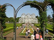
Curitiba’s trademark, created to resemble French gardens, rolls out its flower carpet to the visitors right at the entrance. The greenhouse, with a metallic structure, has botanic species that are national reference, and also a water fountain.

The native forest is filled with paths for hiking. The Botanic Museum attracts researchers from all over the world. There is a space for exhibitions, library and a theater.

It is located at Eng. Ostoja Roguski Street, s/n°. Opens from 6am to 9pm, during summertime; and from 6am to 8pm during the rest of the year.

  • German Wood
The wood has various features to celebrate and promote the German traditions. There are 38 thousand square meters of native forest, which was part of the old farm from the Schaffer family. The replica of an old wooden church, built in 1933 at the Seminário neighborhood, with neo-gothich decorative elements, shelters a concert hall called Bach’s Oratorium.

Other attractions are the John and Mary path, which tells the Grimm brothers tale, a children’s library, the Philosophers Tower, a wooden observatory allowing a panoramic view of the city and the Ocean Ridge, and the German Poetry Square, with a reproduction of the Casa Mila façade, a German building from the beginning of the last century, originally located in the city center.

It is located at Niccolo Paganini Street, corner with Franz Schubert – Vista Alegre (Jardim Schaffer). The Wood opens daily from 6am to 8pm; the Library, from 9am to 5pm; Story Time on Saturdays and Sundays at 2pm.

  • Barigüi Park
With an area of 1.4 million square meters, it is one of the biggest parks of the city and definitely the most visited. Not only the city residents and the tourists seek rest in the park. Guinea pigs, night herons, white herons, skunks, crown sparrows, song-thrushes and dozens of other native animals make Barigüi their home.

Among the features available in the Park there are: barbeques, kiosks, cycle and model airplanes tracks, multi-sports courts, gym equipment, car park, restaurant, playground, Automobile Museum, Exhibition and Convention Center, Steam Train Station and the Environment Municipal Council headquarters. It is located at BR-277 – Rodovia do Café, Km 0 – Bigorrilho.

  • Barreirinha Park
Regarded as the most beautiful park of the city, one can appreciate araucarias, cinnamon, bracatingas, Paraguay tea plants and other native species. The green area, serving as an important regulator of the air quality in the region, is used by students and university teachers in practical Botanic lessons.

The Municipal Forest, next to the park, has a scientific and educational role – it is responsible for the research and production of vegetable species. Among its features there are woods with over 200 thousand square meters of typical vegetation, children’s library, playground, rustic cabin, snack bar, barbeques and car park.

It is located at 6010 Anita Garibaldi Avenue – Barreirinha. Opens daily, from 6am – 6pm.

  • Gutierrez Wood / Chico Mendes Memorial / Dolls Theater
Implemented in the wood on the 22nd of March, 1989, the Chico Mendes Memorial pays homage to the amazonian rubber extraction leader, who was killed in Xapuri, Acre. It comprises 18 thousand square meters of green area, with paths and a natural spring, supplying 1,350 liters of mineral water hourly. It is home to the Amazônica School and the Dadá Dolls Theater. It is located at Albino Raschendorfer Street, s/n°. – Vista Alegre. Opens daily, from 6am – 6pm.

  • Pope’s Wood
Polish immigration memorial, inaugurated on 13th of December, 1980, following the visit from Pop John Paul II to Curitiba, on the previous July. The area of 46,337 square meters was part of the dispossession involving the old Estearina candle factory.

The seven log houses composing the memorial are a live rememberance of the faith and battle of the Polish immigrants, with objects such as the old cart, the sour cabbage pipe and the image of the patron saint, the Black Virgin of Czestochowa. In Curitiba, the Polish immigration started in 1871. It is located at Wellington Oliveira Vianna Street, s/n°.- Centro Cívico. Opens daily from 6am – 8pm; Memorial Tuesday to Sunday, from 9am to 6:30pm.

  • Portugal Wood
Homage to the Portuguese-Brazilian bonds, this space is highlighted by a track following a small brook, where one can see drawn on tiles excerpts from famous Portuguese language poets, as well as a tribute to the great Portuguese navigators and their discoveries. It is located at Ozório Duque Estrada Street, s/n°. – Jardim Social. Opens daily.

Municipal libraries, located at schools or public places, with a reference collection of five thousand books inspired by two ancient landmarks: the library and the lighthouse from Alexandria. The modular building, with a metallic structure, has a height of 17 meters and 98 square meters of built area.

The internal division is simple: the ground floor – where the books are, a hall and a spiral staircase, leading to the top of the tower, where there is a lair, covered with a metallic vault and above it a rooster.

The Farol das cidades, the only one of its kind, is different from the others because of its collection, made of videos and CD-ROMs, equipped with computers and connected to the Internet and to the City Hall geoprocessing, with free access to the population. It is located at João Gava Street, s/n° - Abranches. Opens from Monday to Friday, from 9am to 9pm, and on Saturday, 9am to 1pm.

  • Jerusalem Fountain
Pays homage to the 3,000 years of Jerusalem. The construction in concrete and masonry has a height of 14.5 meters and was designed bythe architect Fernando Canalli. At the top there are three bronze angels, of approximately 600 kilos each, sculpted by the artist Lys Áurea Buzzi, representing the three main monotheistic religions in the world, who believe in the existence of angels and for which Jerusalem is a sacred city: Christianism, Judaism and Islamism. It is located at Sete de Setembro Avenue, corner with Arthur Bernardes Avenue – Seminário.

  • Memory Fountain
Authored by Ricardo Tod, the horse head in bronze characterizing the fountain pays homage to the old immigrant colonists, who with their carts would come from their small farms at the city’s outskirts to sell their agricultural products at the center. It is located at Garibaldi Square – São Francisco.
Travel to Brazil Fotos Photos Pics Curitiba Parana Brasil TourismMaria Lata D’Água Fountain
Located at the vicinity of the Paranaense Museum, together with the historic houses, it was inaugurated on May 15th, 1996. Structured in concrete, it occupies an area of approximately 36 square meters and has a 60 centimeters deep water mirror. The highlight from the fountain is a reproduction of the sculpture “Água pro Morro”, from the beginning of the 1940’s, from Erbo Stenzel, one of the most important artists from Paraná. It is located at Generoso Marques Square - Center.

  • Arab Memorial
Paying homage to the Middle-Eastern culture, it works as a specialized library. The building reminds of the architectural style of the Moorish buildings, with elements such as the vault, the columns, the arches and the stained glass windows. With just over 140 square meters of built area, the Memorial has a cube shape and is placed over a water mirror. Inside the building, over a marble base is a sculpture representing the writer Gibran Kalil Gibran. It is located at Gibran Khalil Gibran Square - Center.

  • Curitiba Memorial
A space for art and folklore, information and memory, the past and the future. Built on an irregular land, the architectural project allows the creation of spaces and functional and creative installations. The dome, resembling a painting, makes evident the work’s role of cultural origin. It is located at Claudino dos Santos Street – São Francisco. Opens from Monday to Friday, from 9am to 6pm, and on Saturdays, 9am to 1pm.

  • Mocinhas da Cidade Fountain
Located at the crossing of Cruz Machado and Alameda Cabral, pays homage to the couple and country music duo Nhô Belarmino e Nhá Gabriela. With drawings from Fernando Canalli, it has colums with rods, which frame tiled pictures showing the verses of the song “Mocinhas da Cidade”, immortalized by the duo and recorded for the first time at the beginning of the 1950’s.

  • Capão da Imbuia Wood / Natural History Museum
With an internal exhibition of dioramas, stuffed animals and dehydrated vegetables. At the external area is the “Araucarias Path”, a wood remanent from the Araucaria Forest, where an elevated pathway goes trough a 400 meters long path, with 12 windows and panels showing the inter-relations of the natural elements found at the Araucaria Forest and also the different products from this vegetable formation, obtained and used by Man. It is located at Benedito Conceição Street, 407 / Prof. Nivaldo Braga Street, 1225 – Capão da Imbuia. Opens Tuesday to Sunday, from 9am to 5:30pm.

  • Ópera de Arame / Pedreiras Park
It is one of the emblematic symbols of Curitiba, with tubular structure and transparent ceiling, of great beauty. Inaugurated in 1992, it caters for all types of shows, between lakes, typical vegetation and cascades, on an unique landscape. The Opera is part of the Pedreiras Park, together with the Paulo Leminski Cultural Space, where the Passion of Christ was enacted, and hosted many other big events since 1989, and can receive, in open air, 10 thousand people seating or 50 thousand standing. It is located at João Gava Street, s/n°. – Abranches. Opens Tuesday to Sunday, from 8am to 10pm.

  • Rosicrucian Order
The Grand Lodge for Brazil of the Rosicrucian Order implemented in 1956 in Rio de Janeiro was transferred to Curitiba in 1960. The temple is part of an architectural complex of six buildings in Egyptian style, a homage to the first members who would get together in the secret chambers of the great pyramid.

Travel to Brazil Fotos Photos Pics Curitiba Parana Brasil TourismIn the other buildings are the general administration, the Auditorium H. Spencer Lewis, a memorial with a pyramid and the Curitiba Lodge, where the library and museum are located, with reproductions of Egyptian pieces from various dynasties, including papyrus and mommies. It is located at 2641 Nicarágua Street – Bacacheri. Opens from Monday to Friday, from 8:30am to 12 noon, and on Saturdays, 2:30 pm to 5pm.

Iguaçu Park / Zoo
It is the largest urban park in Brazil, with 8 million square meters.
Equipped with car parks, kiosks, bar and snack bar, the park offers many attractions, divided in seven different areas: sports, nautics, fishing, natural wood, public orchards, ecologic sanctuaries and zoo. Here, over one thousand animals from 80 species can be seen: birds from all over South America, reptiles and mammals from many different origins, kept in an environment as close as possible to their natural habitat. It is located at Mal. Floriano Avenue, s/n°. – Alto Boqueirão. Opens from Tuesday to Friday, from 8:30am to 4pm; Saturdays, Sundays and public holidays, from 8:30am to 5pm.

  • Passaúna Park
Almost 6.5 million square meters are within the Passaúna Basin, West of Curitiba. Almost 3.5 million square meters belong to the lake created by the reservoir of the Water Supply Station. A lot of Nature can be seen from above, from the observatory, where a panoramic view surprises with its beauty and grandiosity. Ecologic trails and the Biological Station, an old brickyard, are worth visiting. It is located at Eduardo Sprada Street, s/n° – Augusta. Opens daily.

  • Tanguá Park
Inaugurated in November 1996, it has a total area of 450 thousand square feet. Highlights of the park are two quarries linked by a 45 meters long tunnel, which could be crossed by walk, on a pathway over the water. The park also features a jogging track, cycle track, observatory, snack bar and Poty Lazzarotto Garden. It is located at Dr. Bemben Street, s/n° - Pilarzinho.

  • Tingüi Park
Part of the biggest linear environmental park in the Country, established at the Barigüi river margins, it reminds us of the indians who used to live there, with the statue of Tindiqüera Chieftain. The Ukrainian Memorial is also there, homage to the immigrants, in a replica of an orthodox church, originally built in inland Paraná State, hosting a pêssankas and icons exhibition. It is located at Fredolin Wolf Avenue, s/n° / José Casagrande Street, s/n° - São João. Opens – Park – daily; Memorial – Tuesday to Sunday, 9am to 6pm/ Crafts Shop – Tuesday to Sunday, 2:30pm to 6pm.

  • Public Promenade
It used to be called Botanic Garden. The first public park in Curitiba, it was inaugurated by the president of the Paraná province, Alfredo d’Escragnolle Taunay, on the 2nd of May, 1886. It was the first big sanitation work in the city, transforming a marsh in a leisure area, with lakes, bridges and islands within the green area. Pioneer zoo in Curitiba, even today it shelters small animals. The gate is a copy of what existed at the Paris Dog Cemetery. It is located at Luiz Leão Street, s/n – Center. It is open from Tuesday to Sunday, from 6am to 8pm; the aquarium works from 9am to 5pm, also from Tuesday to Sunday.

  • Japan Square
Homage to the sons of the “Rising Sun”, who settled there dedicating themselves to agriculture. Scattered around the square are 30 cherry trees sent from Japan by the Nipponese empire and artificial lakes Japanese style. In 1993 the Japanese Portal, the Culture House and the Tea House were built. It is located at Sete de Setembro Avenue, junction with Rep. Argentina Avenue – Água Verde. Opens – Culture House – Tuesday to Sunday, 9am to 6pm; Tea Ceremony – Thursdays from 9am to 4pm.

  • Tiradentes Square
It is the main one in Curitiba, dominated by the Basilica Cathedral Minor of Our Lady of Light, centennial in 1993. In this area, on the 29th of March, 1693, Curitiba was founded. Anciently known as Largo da Matriz, the square is the city’s initial landmark. In 1880, because of the emperor D. Pedro II visit to Paraná, the Square became known as D. Pedro II. Nine years later, at the Republic, it has received the current name of Tiradentes Square. It is an important public transport terminal. It is a permanent meeting point, bringing fond memories to the common curitibano memory.

  • Reinhard Maack Wood
Inaugurated in 1989, the wood is a homage from the city to the German geologist and researcher based in Paraná, whose work has contributed to the preservation of the environment in the State. The Wood has an area of remanent araucaria forest, with unique species in the whole region; an adventure trail with educational and ecologic toys for children; recreational equipment; and an evironmental education house. It is located at 70 André Ferreira Camargo Street, Vl Hauer. Opens on weekends and public holidays from 8am to 5pm.

  • 24 Horas Street
The Street that never sleeps is the synthesis of a city which also never sleeps. It is 120 meters long and 12 meters wide. It is composed by 32 arches in metallic tubular structure, trademark of the modern curitibana architecture. There are 34 shops that are open eternally, from the daybreak sandwich to the bank withdrawal; from the pharmacy to the florist; from books to milk for the children. Great meeting point for tourists and curitibanos seeking leisure, pastimes, night life and good eating options. At 24 Horas street it also possible to have free Internet access, day and night. The user just has to schedule a time. It is located between Visconde de Nácar and Visconde do Rio Branco Streets – Center.

  • São Francisco Ruins
A space surrounded by fables, at João Cândido Square. The ruins are made of stone, of what should have been the São Francisco de Paula church, never finished. In 1811 the chapel and the sacristy were finished, but in 1860 the stones that would finish the construction were used to finish the old Matriz tower, currently the Basilica Cathedral Minor of Our Lady of Light. Stories of tunnels and pirates live in the place, today filled with leisure and business spaces, stage and grandstand, forming the “Ruins’ Arcades”.

  • Santa Felicidade
Neighborhood where some of the first Italian immigrants arriving in Paraná settled, where they dedicated themselves to the agricultural production, planting herbs, wine and cheese making and willow tress.

Almost in front of the church is the cemetery, with the unique pantheon made of 18 chapels in neo-classic style, which became heritage through the Historic and Artistic Heritage. Standing out for their architecture, the Geraniums House, the Panels House, the Arcades House and the Culpi House.

The greatest attraction in Santa Felicidade is to be the gastronomic district of Curitiba, with a large number of restaurants offering typical food and wine from the colony. There are also wineries and wine bars, craft stores and willow furniture. Along Manoel Ribas Avenue.

  • São Cristóvão / Italian Wood
A place for the typical parties of the Italian community in the district, such as the Grape Party, the Wine Party and the 4 Giorni in Italy. It has structure for food and drink stalls, space for shows and folkloric presentations and a polenta pot. It is located at Margarida Ângela Zardo Miranda Street, s/n°. Opens from Monday to Friday, from 8am to 5pm.

  • Historic Area
Complex with the oldest buildings in the city. Among these buildings are the Romário Martins House, from the XVIII century and the Church of the Third Order of Saint Francis, from 1737, as well as the architectural examples inspired by the Germans, from the second half of the XIX century. On Sunday mornings, the old stones at the Largo da Ordem and the pavement giving access to Garibaldi Square, with the Rosário Church, the Flowers Clock, the Memory Fountain and the Società Giuseppe Garibaldi make the setting for the Crafts Fair, an exciting meeting point with live music. It is located at Largo da Ordem / Praça Coronel Enéas, Praça Garibaldi – São Francisco.

  • Guaíra Theater
Live memory from the multi-faceted culture of the curitibanos, it is one of the biggest theaters in Latin America. It used to be called Theatro São Theodoro, inaugurated in 1884 at Dr. Muricy Street and rebaptized in 1900 as Guaíra Theater. It was demolished in 1930 and the rebuilding, in 1952, already at the current location, was linked to the celebrations of the Centenary of Political Emancipation of Paraná (19th of December, 1953). It only got finished in the 70’s. There are three auditoriums, the biggest of them with 2173 seats. It is located at XV de Novembro Street, s/n, Santos Andrade Square – Centro.

  • Paiol Theater
Symbol of the cultural change in Curitiba in the 1970’s, it inaugurated the process of recycling the use of buildings which are valuable for the city’s collective memory. Built in 1906, the old gunpowder barn was restored and recycled in the 1970’s, becoming an arena theater. Its inauguration on December 27th 1971, was baptized by the poet Vinícius de Moraes, with whisky and a song specially composed for the occasion, “Paiol de Pólvora”. In the inauguration show, besides the “poetinha”, Toquinho and Marília Medalha also took part. It is located at Chile Street, corner with Reynaldo Machado Street – Prado Velho. Opens daily, from 8:30am – noon and 1pm to 9pm.

  • Mercês Tower
It is at the highest point in Curitiba, allowing a 360 degree vision of the city, from a height of 95 meters. It is managed by Telepar and Curitiba City Hall, which promote video sessions and tourism guidance. Also there is the Telephone Museum. It is located at Prof. Lycio Grein de Castro Vellozo Street, corner with Jacarezinho Street – Mercês. Opens Tuesday to Sunday, from 10am to 7pm.

  • Tropeiros Park
Here the gaucho culture is preserved, brought by the cattle drivers who would pass near Curitiba, conducting the troops towards the Sorocaba Fair, which gave origin to various cities in the State. The park is equipped with installations suitable for rodeos and typical dances. It is located at Maria Lúcia Locher de Athayde Street, 10.000 – Cidade Industrial. It is open on Saturdays, Sundays and public holidays, from 8am to 7pm.

Travel to Brazil Fotos Photos Pics Curitiba Parana Brasil TourismParaná Federal University
It was created in 1912, at Comendador Araújo Street, but still in the 1910’s decade was transferred to the current address, taking over Santos Andrade Square. It is located at Santos Andrade Square, s/n. – Center. Opens – No open visiting

  • Universidade Livre do Meio Ambiente
Within the Zaninelli Wood green, the Universidade Livre do Meio Ambiente made Curitiba the first city in the world to keep a space for studies and transmission of knowledge about the environment and ecology to the population.

The architectural project, performed with rustic materials, repeats in shape and color the four elements of Nature: earth, fire, water and wind. Despite the rare beauty, the main purpose of the space is to create an environmental conscience in the citizen as a survival factor. It was created on the 5th of June, 1991 – at the current space – inaugurated by the French oceanographer Jacques Cousteau – from 1992. It is located at Victor Benato Street, 210. Pilarzinho. Opens daily, from 7am – 6pm.

Shopping

Curitiba is widely served with shopping places. Besides historic places like Rua das Flores, the city has the comfort of many shopping centers. Another interesting shopping and leisure option is the 24 Horas Street.

Wednesday, April 9, 2008

Brazilian Tourism: Chapada Diamantina | State of Bahia

Brazilian Tourism: Chapada Diamantina State of Bahia

Travel to Brazil Fotos Photos Pics Chapada Diamantina Bahia Brasil Tourism Located in the heart of Bahia, Chapada Diamantina is cut by mountains, large plateaus, rivers, rapids, waterfalls, caverns and transparent pools of water. It has several springs sprouting from the rocky cliffs and more than 35 rivers – the largest are the Paraguaçu and Preto Rivers. Due to relief variations and to diverse forms of vegetation, the fauna is very rich and some species can be seen very easily, such as humming birds, parakeets, parrots, capybaras, and small lizards. It also has some small rodents, known as mocós (a kind of guinea pig) – which adapt from the feet of calcareous hills to the plateaus, over the mountain – and even some species of large mammals threatened with extinction, such as jaguars and pumas.

Chapada Diamantina’s attractions are innumerous, which make it difficult to choose where to start. One of these is the Enchanted Well, which receives sun rays from 10:30AM to 12:30PM, allowing the observation – through turquoise blue water – of even the tiny stones deposited 61 m deep. It is located in one of the many caverns in the area and it is the Chapada’s most famous postcard, but bathing is prohibited there.

Another very famous geographic irregularity in the Chapada is Mount Pai Inácio, a natural belvedere where it is possible to see and admire the Chapada Diamantina’s immensity, after a 20 minute walk uphill. It is located 30 km (19 miles) from downtown Lençóis, for a total walk of 5 hours.

There is also the Chapada Diamantina National Park, which occupies an area of 152,000 ha. The beauty found in the area is unique. There are trails with different levels of difficulty – many of them opened by slaves, cattle drivers, and miners – but because there are no signs, the presence of a guide is fundamental, especially on the longer trails.

On all trips, one can observe orchids, bromeliads, common immortelle and cacti – abundant vegetation in the area. But remember: the Park does not have any infrastructure for visitor support. Thus, one should always take sandwiches and water, and do not dispense the help of local tour guides. For those wanting to have a good time on each trip, do not forget bathing clothes, cap or hat, sunscreen, tennis shoes and flashlights with extra batteries – in case of visiting caves.

Sports on the Chapada
  • Canyoning
Canyoning on the Capivari waterfalls, 20 km (12 miles) from Lençóis, is one of the most sought after itineraries. The outing lasts three days and two nights, camping, and includes trekking and rappel on the waterfalls, which is 37 m high.

Fumaça waterfalls, a 48 km (30 miles) trip between Lençóis and Palmeiras, is one of the hardest outings. It lasts four days and three nights, with trekking over the Vale do Capão and tirolesa – a 60 m descent on a steel cable – and then diving into a pool of water, are part of the program.

  • Cascading
Tourists who come to Chapada Diamantina looking for strong emotions will certainly be satisfied. Radical sports, such as cascading and caving are practiced in most waterfalls and caverns, with several levels of difficulty. Cascading on Fumaça waterfalls, in Palmeiras – a 340 m water fall and 420 m from the pool to the top – is the greatest challenge, and it is recommended only for the very experienced sportsman.

  • Rappel
Rappel at Lapão Cave is the perfect attraction for those who never practiced this sport, but are willing to learn. The cave is 4 km (2.5 miles) from Lençóis, and rappel is practiced on the cavern’s mouth, which is more than 50 m high and 1,200 m long. For the most experienced, there is also the Mount Camelo option, one of the Chapada’s symbols, which is 1,050 m high. It is possible to do 240 m of rappel and 200 m more of cliff climbing.

Cave exploring tourism
  • Enchanted Well
This is a 61 m deep lake with dark blue water. The best time for visitation is between April and September, when the cave receives more sunrays, between 10:30AM and 12:30PM. To observe the well – where bathing is prohibited – it is necessary to enter 80 m into the cavern down a steep declivity.

  • Torrinha
This cavern has a great number of rare formations, like stalactites with transparent crystal and aragonite flowers. In some points it is necessary to walk crouched down. There are three tour options to visit Torrinha Cave, with different prices and durations.

  • Lapa Doce
This is an 850 m subterranean cave full of stalactites and stalagmites. Da Pratinha
On this tour, it is possible to visit the external lake and part of the river crossing the cave – wearing a mask and floating vest.

  • Blue
This is a steep cliff with a lake in the background – or a funnel-shaped depression – where the sun shines between 2:30PM and 3:30PM. This can be visited together with Pratinha because they are near each other.

  • Blue Well
This is a bluish colored subterranean lake. The best time for visitation is between 1:30PM and 2:30PM, and it is has easy access.

  • Do Lapão
This cave is made of quartzite, with a 50 m diameter entrance. It is a 3 hour walk over difficult terrain – 5 km (3 miles) starting from Lençóis.

Attractions
  • Lençóis
It is the main destination for those willing to visit Chapada Diamantina. The city has good infrastructure to receive foreign and domestic tourists. It unveils itself in one of Serra do Sincorá’s spurs and its shape resembles a Nativity scene.

Lençóis was granted Historic Heritage status and is considered the capital of diamonds – one of the biggest references among Bahia’s cities connected with mining.

The houses reveal Lençóis aristocratic opulence that lived off the riches and prestige from diamonds. It is interesting to walk through the streets, observing the architectonic traces and city’s streets made of stones from the region. Another attraction is the Sá family residence, today the City Hall, a landmark of the traditional families’ riches. Besides that, Afrânio Peixoto, Lençóis doctor and writer, was born in the same house that today holds the Afrânio Peixoto Museum, which displays many of the writer’s objects, including his novel’s original writings and the ornamented uniform used by the Brazilian Academy of Letters members, to which he belonged.

  • Waterfall Tours
The Waterfall Tours can be done in two steps: the first one is an approximately 3 km (1.8 mile) walk that includes Cachoeirinha, Spring Fall, Halley Well, Colored Sand Room and Serrano. The second, another 3.5 km (2 mile) walk to Ribeirão do Meio. For all walks in the Chapada, it is necessary to wear a good pair of sneakers, light clothing, and take some water and sandwiches. On the longer tours, it is necessary to hire a guide and wear windbreakers for the temperature drops at the end of the afternoon.

  • Spring Waterfall
Located 2 km (1.2 mile) from the city of Lençois, a 45 minute walk, Spring Waterfall is the first of a series of spectacles offered by local nature. This 6 m high waterfall formed by the Grisante Creek, a Lençóis River tributary, is a cold and strong waterfall, great for massaging the body.

  • Halley or Paradise Well
Halley or Paradise Well, as it was originally called, is formed by the Lençóis River and it is located in a canyon. The river runs over a rocky bed and opens up wide, forming a 3 m wide by 10 m long and 2 m deep well.

  • Colored Sand Rooms
These are formed by the erosion of granite rocks and sandstone conglomerates, where artisans collect several hues of sand to fill bottles with several pictures offered to tourists as souvenirs. These bottles can be found in several arts and crafts stores around the area.

  • Serrano Well
The place, an old mine, is a natural belvedere, from where you can see the city and the São José River valley. Further ahead, this will join the first one and flow into the Paraguaçu River. The place provides an invigorating bath.

  • Ribeirão do Meio
Ribeirão do Meio is 3.5 km (2.17 miles) from downtown Lençóis. To get there, the preferred option for German and French tourists as well as tourists from São Paulo is a half an hour horseback ride.

  • Tranquility Waterfall
Tranquility (Sossego) waterfall is located exactly 8 km (5 miles) from the city – a 6 km (3.7 miles) walk along a trail and 2 km (1.3 miles) over the Ribeirão River bed.

  • Mount Pai Inácio
To get there you must climb a 400 m trail connecting the end of the paved road to the top of Mount Pai Inácio. From the peak, which is 1,150 m above sea level, you can see Sincorá Mountain Range, Bacia Mountain Range and Chapadinha Mountain Range. It is located approximately 30 km (19 miles) from downtown Lençóis. It is a 5 hour walk.

  • Mount Camelo
It is located on the Chapada’s north part, next to Mount Pai Inácio. For those willing to walk, there is a 4 km (2.5 mile) long trail. It is approximately 170 m high.